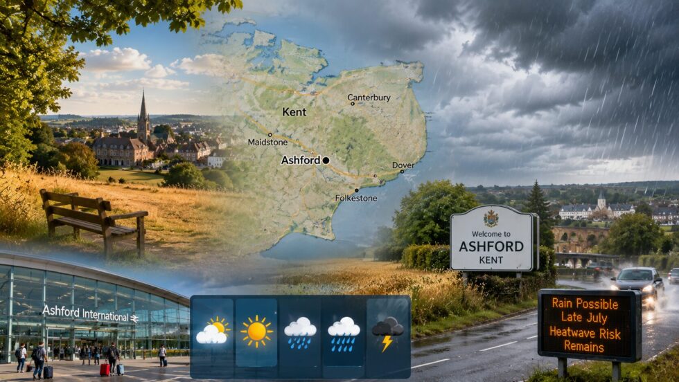
Ashford and the wider Kent area are moving into a less intense phase of the July heat after temperatures exceeded 30C somewhere in the UK for 13 consecutive days, but the change will bring only limited relief from the county’s prolonged dry conditions. Daytime temperatures around Ashford are expected to settle closer to the mid-20s as cooler North Atlantic air reaches south-east England, while the immediate forecast remains predominantly dry and warm. Rain may become more likely towards the end of July, but current Met Office guidance continues to indicate above-average temperatures and the possibility of further hot spells during August, Ashford Chronicle reports.
For residents across Ashford, Canterbury, Maidstone, Folkestone and surrounding rural communities, the central issue is no longer only the daily maximum temperature. Kent entered the second half of July with dry grassland, stressed water supplies and formal hosepipe restrictions affecting South East Water customers. Any short-term cooling will make conditions more comfortable, but scattered showers would not be sufficient to reverse the accumulated rainfall deficit or immediately reduce the risk of grass and vegetation fires.
Ashford weather turns cooler but Kent remains warm and mostly dry
The latest UK heatwave is weakening as high pressure changes position and allows a fresher northerly airflow to move towards southern England. Ashford should therefore experience lower temperatures than those recorded during the hottest stage of the July spell, when parts of southern Britain repeatedly reached or exceeded 30C.
The change is expected to be gradual rather than dramatic. The Met Office forecast for Ashford continues to favour temperatures above the seasonal average, with mostly dry conditions, variable cloud and occasional hazy sunshine. Although isolated showers may develop at times, there is no immediate indication of prolonged rainfall across the town or the wider Kent countryside.
Coastal areas such as Folkestone and Dover may feel slightly cooler because of onshore breezes from the English Channel. Inland locations around Ashford, Tenterden, Maidstone and Canterbury are more likely to become warm during sunny afternoons because the maritime cooling influence is weaker.
The regional Met Office outlook for London and south-east England indicates warm and mainly dry weather, with maximum temperatures around 25C during the initial cooler phase. Light coastal winds may hold temperatures down along the Kent coast, while inland communities remain several degrees warmer.
Ashford and Kent weather outlook by area
| Area | Expected temperature pattern | Rain prospects | Local significance |
|---|---|---|---|
| Ashford | Generally in the low to mid-20s after the heatwave peak | Mostly dry, with only isolated showers initially | Cooler than recent days but still warm enough to maintain dry ground |
| Canterbury | Warm sunny intervals, cooler nights | Very low short-term rain probability | Limited relief for parks, gardens and agricultural land |
| Maidstone | Warm inland afternoons | Mainly dry before late-July uncertainty increases | Continued pressure on water demand |
| Folkestone | Slightly cooler near the Channel | Cloud and an isolated shower possible | Coastal breeze may provide greater relief |
| Dover | Warm but moderated by onshore wind | Mostly dry, with local cloud | Lower daytime peaks than inland Kent |
| Tenterden | Warm rural conditions | Limited rainfall at first | Grassland and farmland remain dry |
| Tunbridge Wells | Warm with variable cloud | Small chance of isolated showers | No immediate end to water restrictions |
| Dartford and north-west Kent | Warm urban conditions | Mainly dry in the short term | Dry vegetation continues to create fire risk |
The difference between Ashford and the coast can be important during warm weather. A breeze at Folkestone may make 23C feel relatively comfortable, while Ashford can become noticeably warmer under the same regional weather pattern.
When will rain return to Ashford and Kent?
The immediate outlook does not promise meaningful rain for Ashford. High pressure is expected to remain close enough to southern Britain to block or weaken many Atlantic weather fronts during the first part of the forecast period.
The Met Office long-range forecast suggests that conditions across England and Wales will remain predominantly dry while temperatures stay above average. The influence of high pressure may weaken towards the final part of July, increasing the possibility of showers, thunderstorms or occasional longer spells of rain.
For Kent, however, the timing and amount of that rain remain uncertain. Scotland, Northern Ireland and northern England are more likely to receive organised rainfall first because they are closer to the usual track of Atlantic low-pressure systems.
Weather fronts reaching south-east England may become weaker as they move across the country. A rain band that produces several hours of rainfall in western Britain can arrive over Kent as little more than cloud and scattered showers.
Thunderstorms present a different possibility. Warm and humid air can produce intense local rainfall over a narrow area, meaning Ashford could experience a heavy downpour while Canterbury, Folkestone or Tenterden remain almost completely dry.
Expected rain development for Ashford and Kent
| Period | Most likely Ashford conditions | Kent-wide pattern | Forecast confidence |
|---|---|---|---|
| 18–20 July | Warm, partly cloudy and mainly dry | Coastal cloud possible, but little organised rain | High |
| 21–24 July | Continued warm weather with sunny periods | Most of Kent remains dry | Moderate to high |
| 25–31 July | Greater chance of showers or thunderstorms | Rain may become more widespread but remain uneven | Moderate |
| Early August | Alternating warm, dry intervals and local rain | South-east England may remain drier than northern Britain | Low to moderate |
| Mid-August | Exact daily conditions cannot yet be predicted | Above-average temperatures and further hot spells remain possible | Low |
Long-range forecasts should not be read as precise daily predictions. Beyond five to seven days, meteorologists assess the likelihood of broad pressure patterns rather than attempting to identify the exact hour rain will reach Ashford.
Why one Kent thunderstorm would not end the dry spell
A brief thunderstorm could provide temporary relief from the heat, but it would not necessarily improve Kent’s wider water position.
After several weeks of dry weather, soil can become compacted. Heavy rainfall may run rapidly across fields, roads and pavements rather than soaking gradually into the ground. This creates the unusual situation in which local flooding can occur during a wider drought or prolonged dry period.
For Ashford and surrounding agricultural areas, steady rain lasting several hours would be more beneficial than a short violent storm. Moderate rainfall has more time to penetrate the soil and replenish moisture available to crops, gardens and natural vegetation.
Reservoirs and underground water resources require rainfall across much larger catchment areas. A thunderstorm over Ashford town centre would have limited value if the relevant rivers, aquifers and reservoir catchments remain dry.
The greatest improvement would come from several periods of sustained moderate rainfall across Kent and neighbouring counties. Current forecasts do not yet provide confidence that such a pattern will develop.
What different kinds of rain would mean for Ashford
| Rain type | Typical duration | Likely effect in Ashford | Wider benefit for Kent |
|---|---|---|---|
| Brief shower | 10–30 minutes | Wet roads and temporary cooling | Very limited |
| Local thunderstorm | Up to two hours | Intense rain, lightning and possible surface flooding | Highly uneven |
| Weak weather front | Several hours | Light or moderate rain across a broader area | Some benefit to soil |
| Slow-moving rain band | Six hours or more | Sustained rainfall and lower temperatures | Meaningful benefit |
| Repeated rainy days | Several days | Gradual recovery of soil moisture | Best outcome for water resources |
Kent therefore needs rainfall of sufficient duration and geographic coverage rather than a single dramatic weather event.
Kent hosepipe ban remains in force despite cooler weather
South East Water introduced a temporary use ban for customers in its Kent supply area from 00:01 on 3 July. The restrictions cover Ashford and several other communities, including Canterbury, Faversham, Maidstone, Sevenoaks, Snodland, Tenterden and Tunbridge Wells. The ban was introduced after sustained high temperatures, low rainfall and exceptionally high demand placed pressure on treated drinking-water supplies. A fall in temperature does not automatically remove those restrictions because water resources respond much more slowly than the daily weather.
Under the restrictions, affected customers must not use hosepipes for activities including watering gardens, washing cars, cleaning patios or boats and filling swimming or paddling pools.
Residents can generally continue watering plants with a watering can filled directly from a tap, subject to the detailed rules and exemptions published by South East Water. Businesses and people with medical or accessibility requirements may also qualify for specific exemptions.
The restriction will remain relevant even if Kent receives showers during late July. Water companies assess reservoir levels, groundwater, river flows, demand and the wider seasonal forecast before deciding whether a temporary use ban can be lifted.
What the Kent hosepipe restriction means
| Activity | Hosepipe use under the restriction |
|---|---|
| Watering a domestic garden | Not normally permitted |
| Washing a private vehicle | Not normally permitted |
| Cleaning a patio or driveway | Not normally permitted |
| Filling a paddling or swimming pool | Not normally permitted |
| Watering with a watering can | Generally permitted |
| Essential health or safety use | May be exempt |
| Commercial activity | Depends on the detailed exemption rules |
Residents should check the official South East Water guidance because exceptions depend on how the water is being used rather than simply where the customer lives.
Ashford and rural Kent remain exposed to grass fires
Lower temperatures will not immediately remove the risk of grass, farmland or woodland fires around Ashford.
Vegetation that has dried during repeated hot spells can remain highly flammable after the air becomes cooler. Grasslands, roadside verges, fields and heathland need meaningful rain before their moisture content rises sufficiently to reduce the danger.
Kent Fire and Rescue Service warns that grass fires often occur after prolonged dry weather and can spread rapidly, threatening property, wildlife and natural landscapes.
The service attended a wildfire in Dartford on 17 July and again warned that hot weather can leave the ground extremely dry, allowing fires to start and spread quickly. Residents were advised not to light bonfires or barbecues near grass or undergrowth, not to discard cigarettes and to take reflective litter home.
A grass fire was also reported near Ospringe and Faversham during the July dry period, demonstrating that the threat is not limited to one part of the county.
Ashford’s position within a largely rural district increases the importance of prevention. The borough contains farmland, woodland, dry verges and open recreational areas where a small ignition source can become difficult to control in warm or windy conditions.
Main fire risks around Ashford and Kent
| Risk source | Why it matters during dry weather |
|---|---|
| Disposable barbecues | Heat can ignite dry grass beneath or beside the barbecue |
| Cigarettes | A discarded cigarette can smoulder before starting a larger fire |
| Bonfires | Sparks can travel into fields or undergrowth |
| Glass bottles and litter | Reflective material can concentrate sunlight or obstruct emergency access |
| Farm machinery | Hot surfaces or sparks can ignite dry crops and stubble |
| Vehicles parked on grass | Exhaust systems can become hot enough to ignite vegetation |
Residents should report visible fires immediately rather than attempting to deal with a spreading grass fire themselves.
Could another Ashford and Kent heatwave return in August
Another period of hot weather remains possible because the wider pressure pattern continues to favour temperatures above the seasonal norm. The Met Office outlook for the period from the end of July into the first half of August indicates a somewhat more changeable pattern, but it also retains the possibility of hot spells. Drier and brighter intervals are considered more likely across southern and south-eastern England than in northern Britain.
Kent is particularly exposed when high pressure establishes itself over southern Britain or continental Europe. Under that pattern, winds can draw very warm air northwards from France and across the Channel. Ashford often becomes warmer than nearby coastal communities because it lies inland. The town does not receive the same direct cooling influence from the sea as Folkestone or Dover.
A heatwave would require local temperatures to meet or exceed the regional threshold for at least three consecutive days. It is therefore possible for Ashford and inland Kent to enter heatwave conditions while coastal districts remain slightly cooler.
Weather patterns that could affect Ashford in August
| Pressure pattern | Likely effect on Ashford | Heat risk |
|---|---|---|
| High pressure directly over southern England | Sunny, dry and increasingly hot | High |
| High pressure east of Britain | Warm or hot continental air moves into Kent | High |
| Azores high extending towards the UK | Warm, settled weather with limited rain | Moderate to high |
| Atlantic low pressure crossing Britain | Cloud, rain and lower temperatures | Low |
| Low pressure west of the UK | Humid southerly flow before rain arrives | Moderate |
| Weak mobile systems | Mixed sunshine, showers and average warmth | Low to moderate |
The presence of rain in the long-range forecast therefore does not eliminate the heatwave risk. Kent could experience several unsettled days followed by another rapid rise in temperature.
Why Ashford may remain warmer than coastal Kent
Kent’s geography produces noticeable differences over relatively short distances. Folkestone, Dover and other coastal communities are directly influenced by the Channel. During summer, onshore winds carry relatively cooler air over the coast, limiting afternoon temperatures.
Ashford lies farther inland and is surrounded by rural land. When winds are light and skies are clear, temperatures can rise more quickly during the afternoon. Cloud can also vary across the county. Coastal districts may remain under low cloud or sea mist while Ashford experiences longer periods of sunshine.
The opposite pattern can occur during thunderstorms. Inland heating may trigger showers around Ashford, the Weald or the North Downs while the immediate coast stays dry.
Typical local differences during warm weather
| Location | Main summer influence | Likely result |
|---|---|---|
| Ashford | Inland heating | Higher afternoon temperatures |
| Folkestone | English Channel breeze | Cooler conditions near the coast |
| Dover | Coastal wind and cloud | Lower peak temperatures |
| Canterbury | Inland but closer to the north Kent coast | Warm with some maritime influence |
| Maidstone | Sheltered inland position | Warm or hot during settled weather |
| Tenterden | Rural inland landscape | Strong daytime heating and cooler nights |
These variations mean a county-wide temperature figure cannot describe conditions everywhere in Kent.
What Ashford residents should expect during the second half of summer
The most credible forecast is for a mixed but generally warm period rather than a complete return to cool and wet weather.
Ashford should receive some relief from the recent extreme temperatures as daytime values move back towards the mid-20s. Nights should also become more comfortable than during the peak of the heatwave. Rain chances are expected to increase towards the end of July, but meaningful rainfall is not guaranteed. Kent may receive local showers or thunderstorms while remaining drier overall than western and northern parts of the UK.
The hosepipe ban affecting South East Water customers remains in force, and residents should not assume that one rainy day will bring the restrictions to an end. The risk of grass and vegetation fires will also continue until the county receives sustained rain. Particular care is required around fields, woodland, parks and roadside grass.
Further hot weather remains possible during August. The summer pattern is becoming more changeable, but long-range forecasts continue to favour above-average temperatures and drier intervals across south-east England. For Ashford, that means the latest heatwave may be ending without the wider hot and dry summer being over.
Detailed monthly weather forecast for Ashford and Kent
Long-range forecasts indicate that Ashford and much of Kent will remain warmer than average through the rest of July and into the first half of August. While the recent heatwave is easing, there is currently no strong signal for a prolonged spell of cool, wet weather across south-east England. Instead, forecasters expect alternating periods of sunshine, brief cooler intervals and occasional showers, with the greatest chance of more organised rainfall developing towards the end of July. Confidence is highest during the next seven days and gradually decreases into August, when forecasts focus on overall weather trends rather than exact daily conditions.
High pressure is expected to remain an important influence across southern England for much of the period. This should allow lengthy sunny spells, relatively light winds and temperatures generally above the seasonal average. Atlantic weather systems are likely to become more active later in July, but many of them may weaken before reaching Kent, meaning rainfall could remain patchy and highly localised.
Ashford and Kent four-week weather outlook
| Period | Daytime highs | Overnight lows | Rain probability | Sunshine | Forecast confidence | Expected conditions |
|---|---|---|---|---|---|---|
| 18–24 July | 23–26°C | 13–16°C | 10–20% | High | High | Heat eases, mainly dry with long sunny spells, low humidity and light northerly winds. |
| 25–31 July | 22–27°C | 13–17°C | 30–50% | Moderate to High | Moderate | More variable weather develops with scattered showers or isolated thunderstorms, although many areas remain dry. |
| 1–7 August | 22–28°C | 13–17°C | 25–40% | High | Moderate-Low | Warm conditions continue with alternating sunny days and occasional Atlantic fronts. Above-average temperatures remain likely. |
| 8–17 August | 21–29°C | 12–17°C | 30–45% | Moderate | Low | Mixed summer pattern. Warm spells remain possible if high pressure rebuilds over southern Britain. |
Weather trends most likely to affect Ashford
| Weather factor | Expected trend | What it means locally |
|---|---|---|
| Temperature | Mostly above average | Warm afternoons continue despite the end of the latest heatwave. |
| Rainfall | Gradually increasing | Showers become more frequent later in July, but widespread soaking rain remains uncertain. |
| Thunderstorms | Moderate risk | Brief heavy downpours are possible, especially during humid periods, but will be highly localised. |
| Sunshine | Above average | Many days should remain bright with extended sunny spells across Kent. |
| Wind | Mostly light north or north-east | Cooler mornings and more comfortable daytime conditions than during the recent heatwave. |
| Humidity | Lower initially, rising later | The air should feel fresher after the heatwave before becoming more humid if thunderstorms develop. |
| UV levels | High to very high | Strong sunshine remains likely on clear afternoons, particularly during late July. |
Could another heatwave return
Current long-range guidance suggests another heatwave cannot be ruled out during August. If high pressure strengthens over southern Britain or western Europe, temperatures across inland Kent, including Ashford, Maidstone and Tenterden, could once again climb towards or above 30°C. At the same time, coastal locations such as Folkestone and Dover would probably remain several degrees cooler because of sea breezes from the English Channel. The most likely scenario is therefore a warmer-than-average month with intermittent showers rather than a complete breakdown into wet weather.
Follow Ashford Chronicle for daily news from Ashford and Kent — traffic, property, business and the decisions shaping the borough. Read more from Ashford Chronicle: Eurostar and Ashford International: what we know about the 2029 return and why it may not happen